About Me!

This blog is about my musings and thoughts. I hope you find it useful, at most, and entertaining, at least.
Other Pages
Presence Elsewhere
Projections and Why They're Important
Date: 2015-07-25
Tags: gis projection
In GIS a projection defines how a three dimentional object is drawn in two dimentions. There are two basic types of projections, Geographic Coordinate Systems (GCS) and Projected Coordinate Systems (PCS). While there is much to be said about different types of projections, and I would highly recommend starting with the wikipedia article and moving to the ones on the ESRI site, here I’m going to focus on the difference and usage GCS and PCS.
GCS is a three dimensional model that is fit to the Earth and how to map that to a two dimensional surface. A position on it is measured as the angle north or south of the Equator and east or west of the Prime Meridian. An example is the familar WGS84/EPSG 4326 (GPS coordinates). However, since the Earth isn’t a perfect spheroid, GCS are OK everywhere, but better in some places.
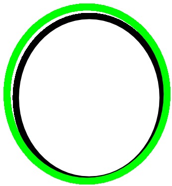
The green line represents the shape of the Earth, whereas the black line represents a perfect sheroid; the match is very close in the bottom right, but not as good in the top left.
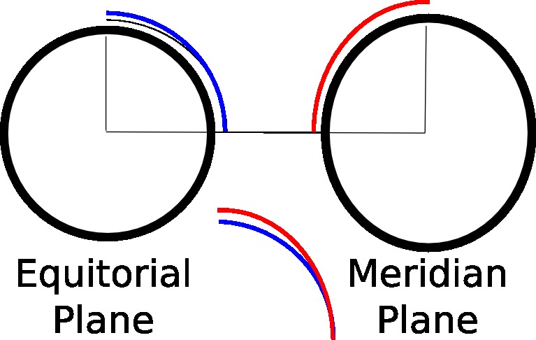
A PCS, on the other hand, is defined on a two dimensional surface and how to map that onto a three dimentional model. A position on it is measured as a unit of length (often the meter or foot) left or right and above or below an origin. An example is the Pennsylvania South State Plane which is valid for the souther counties in Pennsylvania and UTM Zone 17N (used in the Military Grid Reference System).
PCS are valid over a smaller area than a GCS, but allow for more accurate measure of length and area within those smaller areas; this is because the Earth isn’t spherical and an angular change at the Equator is not equal to an angular change on the Prime Meridian. And the irregularities of the shape of the Earth make compesnsation for the spheroidal shape still imperfect.
As an example, if I wanted to create a 110mi buffer around Pittsburgh, which is approximately 2 degrees at my latitude.
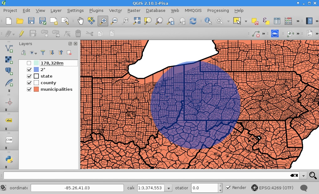
However, I know that Erie is roughly 110mi from Pittsburgh (about 120mi driving), so I immediately knew something was wrong. It dawned on me that I had used a GCS and I’m a bit beyond where you can fudge a measure up equals a measure left. I converted my layer to a PCS, Zone 17N, which uses meters as its base unit and created a 178km buffer.

That looked more realistic and I double checked some distances to some destinations in Ohio, Pennsylvania, and Weste Virginia to be sure.
To illustrate the difference, I overlayed my original 2 degrees buffer.
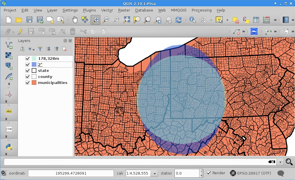
You can see that 2 degrees, when measured in meters, is an oval, and not a circle.
To sum up: use a GCS when you are dealing with the relationship between objects over a very wide area and a PCS when you are dealing with linear measurments (e.g. distance and area). Which GCS or PCS to use is another set of posts.